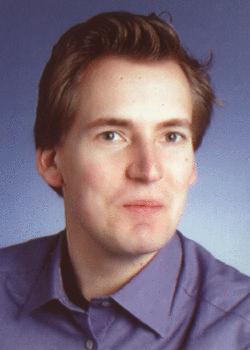
Dr.-Ing. Sönke Müller
Leibniz Universität Hannover
Institut für Photogrammetrie und GeoInformation
Nienburger Straße 1
30167 Hannover
phone: +49 511 762-4922
fax: +49 511 762-2483
Sönke Müller left the Institut für Informationsverabeitung.
Publications and research activities from the time after the departure are not listed here.
Sönke Müller was born in Delmenhorst in 1974. He studied Electrical Engineering with a focus on Information Processing at the Leibniz Universität Hannover. In 2001 he was doing a graduate internship at Robert Bosch spol. s r.o., Budweis, in the Czech Republic. His Studienarbeit (first student research project) was dealing with 'Radiometric equalization of remote sensing data'. In parallel to his studies, from 2000 to 2002, he worked as a teaching assistant at the 'Institut für Informationverarbeitung', Leibniz Universität Hannover, on various projects of knowledge based image interpretation. His diploma thesis was dealing with 'Fingerprint matching algorithms' for smart card applications. This work was done together with Philips Semiconductors GmbH, Hamburg, ending in a patented method. He received his Dipl.-Ing. degree in 2002. Since then he has been working as a research assistant towards a PhD degree at the 'Institut für Informationverarbeitung', Leibniz Universität Hannover, on several projects in the field of image processing and interpretation of remote sensing image data.
Show recent publications only
  • Conference Contributions
    • Christian Becker, Marcell Ziems, Torsten Büschenfeld, Christian Heipke, Sönke Müller, Jörn Ostermann, Martin Pahl
      Multi-Hierarchical Quality Assessment of Geospatial Data
      ISPRS, International Society for Photogrammetry and Remote Sensing, Beijing, 2008
    • Petra Helmholz, Christian Becker, Christian Heipke, Soenke Müller, Joern Ostermann, Martin Pahl, Marcel Ziems
      Semi-automatic verification of geodata for quality management and updating of GIS
      IntArchPhRS, Vol. 36, No. 4, pp. 9-13, Urumchi, August 2007
    • A. Busch, M. Gerke, D. Grünreich, C. Heipke, P. Helmholz, C.-E. Liedtke, S. Müller
      Automated Verification of a Topographic Dataset Using IKONOS Imagery
      IntArchPhRS, pp. 134-139, Goa, 2006
    • Soenke Müller, Daniel Wilhelm Zaum
      Robust Building Detection in Aerial Images
      Proc. Joint Workshop of ISPRS and DAGM: CMRT05, Vienna, Austria, No. 3, pp. 143-148, August 2005
    • Gerald Eckert, Soenke Müller, Torsten Wiebesiek
      Efficient Minutiae-Based Fingerprint Matching
      IAPR Conference on Machine Vision Applications MVA, Tsukuba, Japan, pp. 554--557, May 2005
    • Christian Heipke, Claus-Eberhard Liedtke, Sönke Müller
      Mix and match for quality
      Geospatial Today, Vol. 3, No. 7, pp. 26-29, May 2005
    • Andreas Busch, Markus Gerke, Dietmar Grünreich, Christian Heipke, Claus-Eberhard Liedtke, Soenke Müller
      Automatisierte Verifikation topographischer Geoinformationen unter Nutzung optischer Fernerkundungsdaten: Systemdesign und praktische Ergebnisse
      Photogrammetrie - Fernerkundung - Geoinformation, Vol. 127, No. 2, pp. 111-122, April 2005
    • Martin Weis, Sönke Müller, Claus-Eberhard Liedtke, Martin Pahl
      A framework for GIS and imagery data fusion in support of cartographic updating
      Information Fusion, Vol. 6, No. 4, pp. 311-317, 2005
    • Sönke Sönke Müller, Guilherme Lucio Abelha Mota, Claus-Eberhard Liedtke
      Multitemporal Interpretation of Remote Sensing Data
      Proc. 20th ISPRS Congress, July 2004
    • G.L.A. Mota, K. Pakzad, S. Müller, S. P. Meirelles, R. Q Feitosa, H.L. da C. Coutinho
      A Framework for Automatic Low-Resolution Satellite Image Interpretation Based on Spectral, Contextual and Multitemporal Knowledge
      Proc. 20th ISPRS Congress, July 2004
    • A. Busch, M. Gerke, D. Grünreich, Ch. Heipke, C.-E. Liedtke, S. Müller
      Automated Verification of a Topographic Reference Dataset: System Design and Practical Results
      Proc. 20th ISPRS Congress, July 2004
    • Soenke Müller, R. Feitosa, G. Mota, D. da Costa, V. da Silva, K. Tanisaki
      GEOAIDA Applied to SPOT Satellite Image Interpretation
      Proc. URBAN 2003 - 2nd GRSS/ISPRS Joint Workshop on Remote Sensing and Data Fusion over Urban Areas, May 22-23, Berlin, Germany, 2003
    • G. Mota, S. Müller, R. Feitosa, H. Coutinho, M. Meireiles, H. Vieira
      An Evaluation of Knowledge-Based Interpretation Applied to Low-Resolution Satellite Images
      Proc. IGARSS 2003 - IEEE International Geoscience and Remote Sensing Symposium, 21-25 July, Toulouse, France, 2003, 2003
    • S. Müller, M. Weis, C.-E. Liedtke, M. Pahl
      Automatic Quality Surveillance of GIS Data with GEOAIDA
      Proc. PIA 2003 - ISPRS Conference on Photogrammetric Image Analysis, Sep. 17-19, Munich, Germany, 2003
    • J. Bückner, S. Müller, M. Pahl, O. Stahlhut
      Semantic Interpretation of Remote Sensing Data
      Proc. ISPRS2002, September 9-13, 2002, Graz, Austria, 2002